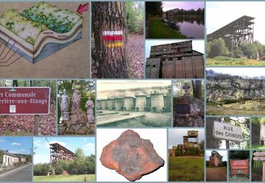
13,3 km | 16,5 km-effort
chatellier
sitydomer
Utente
Lunghezza
6 km
Altitudine massima
193 m
Dislivello positivo
44 m
Km-Effort
6,6 km
Altitudine minima
176 m
Dislivello negativo
43 m
Boucle
Sì
Data di creazione :
2021-10-10 13:53:11.559
Ultima modifica :
2021-10-10 17:53:24.19
1h36
Difficoltà : Medio
Applicazione GPS da escursionismo GRATUITA
Chi siamo
Percorso Marcia di 6 km da scoprire a Normandia, Orne, Le Châtellier. Questo percorso è proposto da sitydomer.
Descrizione
voie verte
Localizzazione
Paese:
France
Regione :
Normandia
Dipartimento/Provincia :
Orne
Comune :
Le Châtellier
Località :
Unknown
Partenza:(Dec)
Partenza:(UTM)
678047 ; 5394173 (30U) N.
Commenti
Percorsi nelle vicinanze
Circuit of IRON by Yannick-p14-61
Marcia
Medio
(1)
La Ferrière-aux-Étangs,
Normandia,
Orne,
France
3h 35min
Sì
La Ferrière - La Ferrière aux Etangs
Marcia
Medio
La Ferrière-aux-Étangs,
Normandia,
Orne,
France
14,3 km | 17,9 km-effort
3h 4min
Sì
1h16
Marcia
Medio
La Ferrière-aux-Étangs,
Normandia,
Orne,
France
6,4 km | 8,5 km-effort
1h 16min
Sì
puits de mine
Marcia
Medio
Saint-Clair-de-Halouze,
Normandia,
Orne,
France
5,6 km | 6,7 km-effort
1h 41min
No
La Feriere aux etant
Marcia
Molto facile
La Ferrière-aux-Étangs,
Normandia,
Orne,
France
1,2 km | 1,3 km-effort
36min
Sì
Dompierre; trace GPS du 10/09/2019
Marcia
Molto facile
Dompierre,
Normandia,
Orne,
France
8,2 km | 10,2 km-effort
4h 30min
Sì
Gare de St Bômer - Forges de Varennes - La Nocherie par la Voie Verte.
Marcia
Molto facile
Saint-Bômer-les-Forges,
Normandia,
Orne,
France
8,1 km | 9,6 km-effort
2h 0min
Sì